Expedition 2023
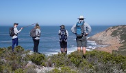
We began hiking on the 30th July from Blombos and finished at Koppie Alleen on the 7th August, having hiked 157km. Unfortunately we were not granted access to the section between Koppie Alleen to Struisbaai, but hopefully in the future we will be able to survey this section of shoreline.
The terrain was a blend of rocky shoreline, cliff top trails and long stretches of sandy beaches along a coastline that is internationally renowned for it's rich fish reserves and large population of breeding Southern Right Whales that migrate annually from the polar region to give birth and mate.
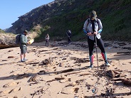
In all, we completed 18 Trashy20 surveys at 5Km intervals, each with three 10m x 2m transects.
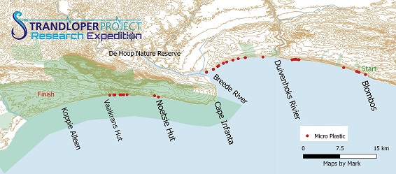
Micro plastics
The route followed a remote coastline consisting primarily of agricultural and low density rural population through which the Breede River flows, draining into the ocean at Witsand. As one of the longest rivers that we have crossed during our expeditions, the Breede River passes through more than four significant urban settlements and we were interested to determine the rate of plastic pollution that escapes into the ocean from this river. Surprisingly, we did not document lots of large plastic items, however there were high densities of micro plastics as well as nurdles, particularly east of the Breede River Mouth. This is a trend that we have recorded on previous expeditions. Most large plastic items are collected by a combination of beachgoers and municipal workers along strip of shoreline that is 4.5Km from a public access point.
A large section of the shoreline that we hiked on this expedition is remote and not accessed frequently, as such there is no information on the level of plastic pollution and fishing debris available. An analysis of our data revealed that there were distinct dispersal patterns of the plastic, with an exceptionally high accumulation documented, with micro plastic mostly found along the shoreline 12km east of the Breede River. This reinforces our view that rivers, along the length of coastline surveyed during our expeditions, are major sources of plastic pollution flowing into the ocean.
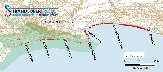
The Scourge of Water Bottles
As expected, we documented empty water bottles along the entire expedition. The highest density was between Cape Infanta and Blombosstrand, with the most common size being 1.5l. There were also a large proportion of 2l soft beverage bottles recorded.
In May 2019, on our first coastal expedition, it was at Blombos Strand that we encountered extremely high bottle counts, compelling us to modify our Cybertracker app to be able to document washed up bottles accurately. So, it is disturbing to see that nothing has been done to stem the flow of plastic bottles reaching the ocean.
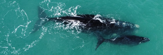
Marine Protected Areas and limited access Coastline.
Considered one of the best coastal trails in South Africa, we were fortunate to be allowed to hike the coastal section of the Whale Trail in De Hoop Nature Reserve, finishing our expedition at Koppie Alleen.
De Hoop is one of South Africa's renowned MPA's, and is considered to be the most important breeding ground for the Southern Right Whale meta population which overwinters in South African coastal waters, and we were indeed privileged to watch over 100 of these leviathans floating in the shallows as we measured the level of plastic pollution and washed up ALDFG in the MPA. Watch Whales in De Hoop Nature Reserve. From Koppie Alleen alone, we counted 60 adults and 58 calves in an arch of 180 degrees from the shoreline.
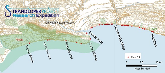
Mapping Fishing Debris.
The presence of lost and discarded fishing gear along the eastern section of the De Hoop MPA and east of the Breede River mouth, fits in with similar recordings of washed up fishing gear in proximity to Marine Protected Areas, suggesting that commercial fishing vessels target the buffer zones of MPA's and that that inshore currents carry fishing debris up to 50km eastwards from where they are lost.
African Oystercatchers
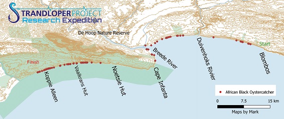
On all our expeditions, the Strandloper Project has recorded sightings of African Black Oystercatchers. During the 2023 expeditions we recorded 180 Oystercatchers, with 113 recorded in the De Hoop MPA, a density of 5.95 oystercatchers/Km in the MPA. While this is not the highest density of oystercatchers that we have documented, it is above average of population densitiesrecorded in our expedition range. By contrast, the population density of oystercatchers outside of the reserve was 1.7 oystercatchers/Km, though this could be attributed the long sections of sandy beaches which usually have a lower density of oystercatchers than that of rocky shores.
|