Expedition 2025
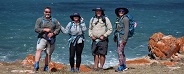
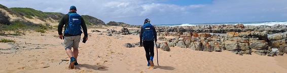
Our 2025 Coastal Research Expedition was 178km hiked over 11 days and retraced the 2019 expedition route, starting at Blombos Nature Reserve and finish at the coastal village of Wilderness.
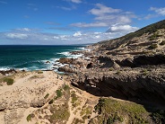
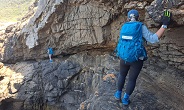
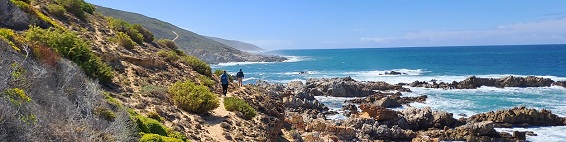
The shoreline was a mix of rocky shoreline, sandy beaches and steep ocean cliffs with a boat assisted river crossing of the Gouritz River.
.
Expedition Objectives
The goal for our second series of expeditions was to get a comparison of the ocean plastic waste and fishing debris along the shoreline that we have already surveyed. To capture geo referenced data, we used a combination of survey methods in the CyberTracker app.

Expedition Survey Methods
Trashy20 Survey
Conducted every 5km, this survey entails collecting and categorizing all plastic waster and fishing debris in three 10m x 2m transects.
Mini Transects
A total count of micro plastics, nurdles and plastic bottle tops along a random transect of between 1m and 10m.
Bottle Transect
A total count of plastic bottles over a measured distance.
Incidental Survey
Documentation of plastic waste and fishing debris not included in structured surveys.

Marine Fauna Surveys
Documenting the number and status of marine fauna seen. Details of injury and possible cause of death are also recorded, especially plastic ingestion, entanglement and ghost fishing.
African Black Oystercatcher Survey
A focused survey of this species to map the population density variations along the shoreline. On our initial expedition in 2019, our emphasis of recording coastal fauna, and particularly bird species, was to document injured and dead birds only. In hindsight, we realized that we had missed some valuable information by not documenting live birds, especially African Black Oystercatchers.
Sighting records from our expeditions from 2020 through to 2024 have provided valuable data for African Black Oystercatchers which have allowed some insights into factors influencing the variations of African Black Oystercatcher population density in the Southern Cape, which can read from this link : Read Here
Cape Clawless Otter Survey
A focused survey of this species to map the population density variations along the shoreline. In addition to live sightings, we record scat and spoor.

Special Focus
In August 2020 approximately 176tons of plastic nurdles were lost at sea along the Eastern Cape coastline. From November 2020, a three year cleanup program was conducted by SpillTech. The clean up operation was a manual process involving sieving sandy beaches and removing the nurdles. During the sieving process, large amounts of micro plastics were also collected. Sadly, the protocol, because it was not within the nurdle cleanup contract, was to dump the micro plastics into piles on the beach after the nurdles had been removed. On our 2021 expedition, we documented numerous plastic middens between Struisbaai and Pearly Beach. This was a lost opportunity to remove micro plastic from the shoreline.
.
Results
Plastic Pollution

Using indicators of plastic bottles, plastic lids, earbud shafts and sucker sticks, the distribution of plastic indicates that west of the Gouritz River mouth, most of the plastic is from fishing vessels, while east of Gouritz River mouth, the source of plastic is from terrestrial urban settlements, flowing into the ocean from rivers and municipal infrastructure.
1.5l water bottles are commonly used on small fishing vessels, and their distribution indicates where fishing activity is concentrated. In conjunction with the distribution of commercial fishing gear, the water bottle distribution shows that fishing activity is concentrated around the Stil Bay Marine Protected Area. The lower density of water bottles east of Gouritz River Mouth indicates lower fishing activity from there to Wilderness.
By contrast, the distribution of carbonated and flavoured drink bottles shows an increase east of the Gouritz River mouth and is indicative of an urban source of the litter.

Sucker sticks are predominantly an urban plastic trash item and there high density between Mossel bay and Glentana reflect there origins from terrestrial sources.
Nurdles and Microplastics
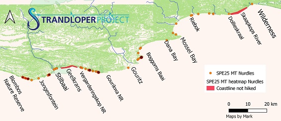
In 2019, we recorded high concentrations of nurdles and microplastics between Blombos and Gouritz River mouth. This was significant as it preceded the August 2020 nurdles spill offshore from East London that washed up from the eastern Cape to False Bay. Sadly, we again recorded high densities of nurdles, especially between Blombos and Gourikwa nature Reserve. The high densities and the different type (colour, size and shape) of the nurdles suggest that there is a constant flow of these into the ocean. While there could be a source from shipping with systematic loss, it is more likely that the continued washout of nurdles is from rivers and urban settlements where there are plastic industries. The volume of nurdle observed with densities between 30 and 300 nurdles per 1m of shoreline indicate a high level of nurdle loss, which in addition to being and environmental hazard, also reflects a financial loss to the companies involved.
Support and Sponsorship
The success of each of the Strandloper Project is entirely dependent on a phenomenal team of volunteers and sponsors. Our core requirements for each expedition are accommodation, fuel, catering and apparel, especially all weather protection. Contact our volunteer team by email to find out how you or your company can support Strandloper Project on their valuable citizen science research expedition. |